

Presented By: Seth Morgan
Event: ECHO East Africa Symposium II on Best Practices in Highland Areas (2016-11-01)
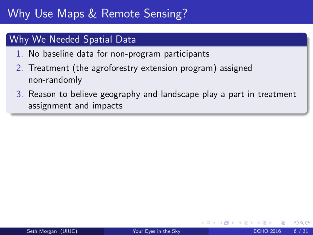
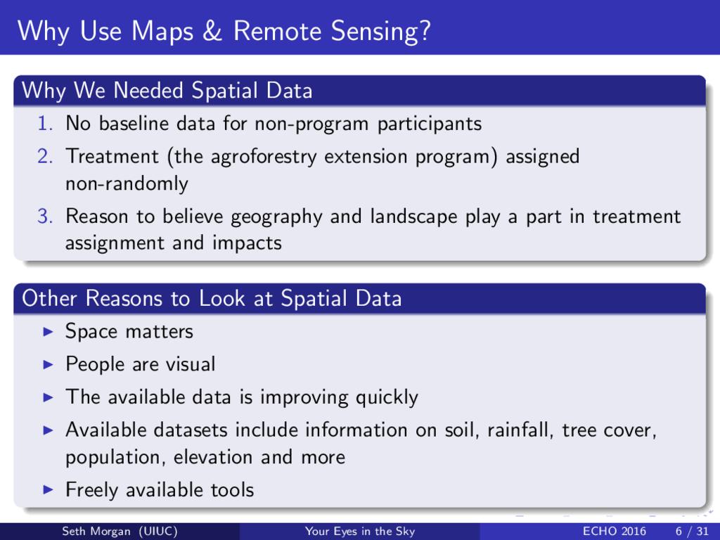
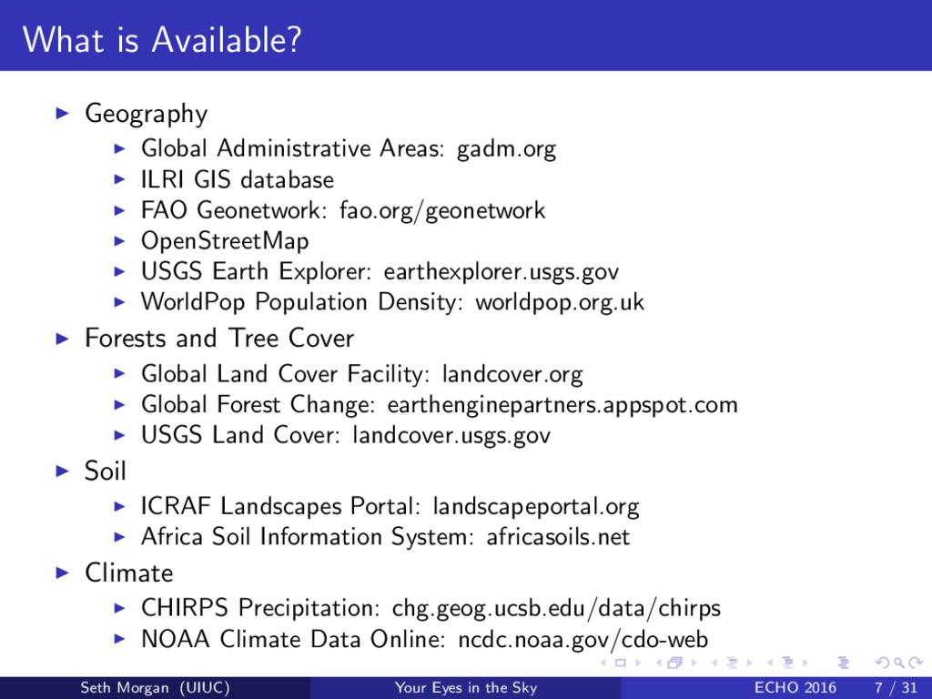
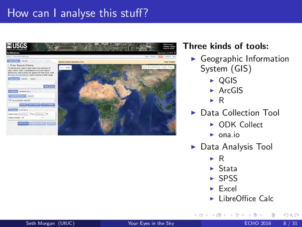
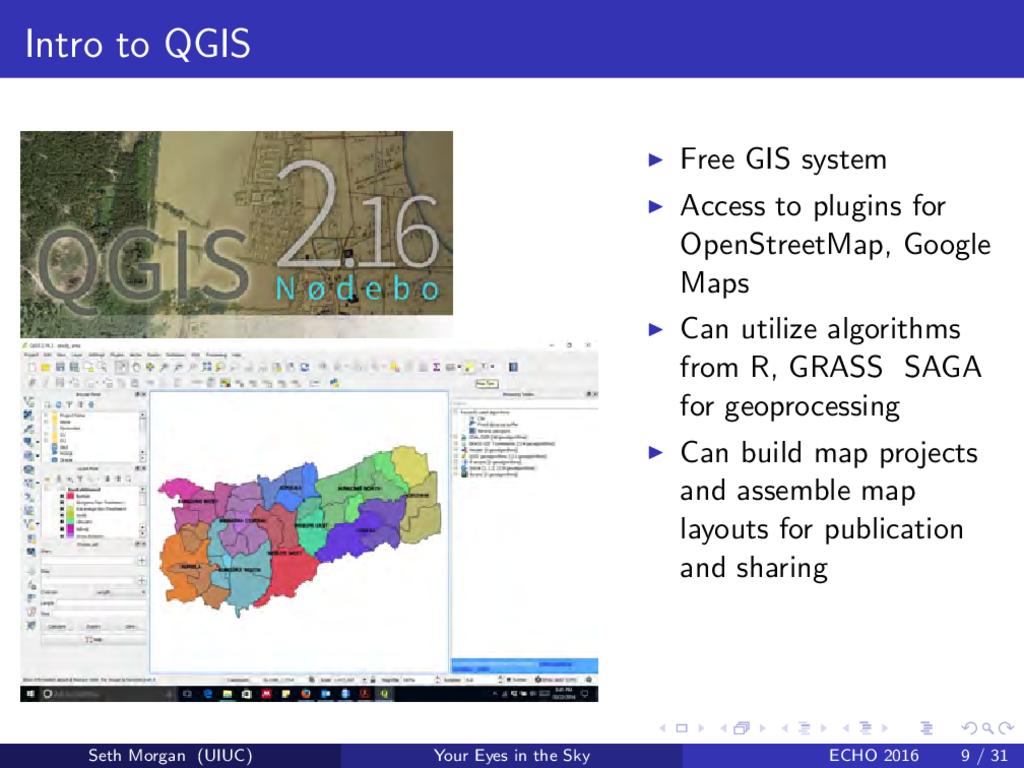
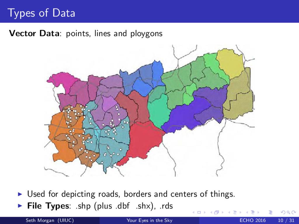
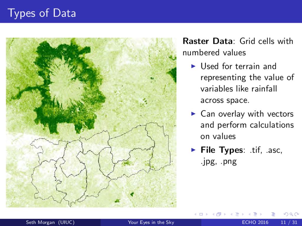
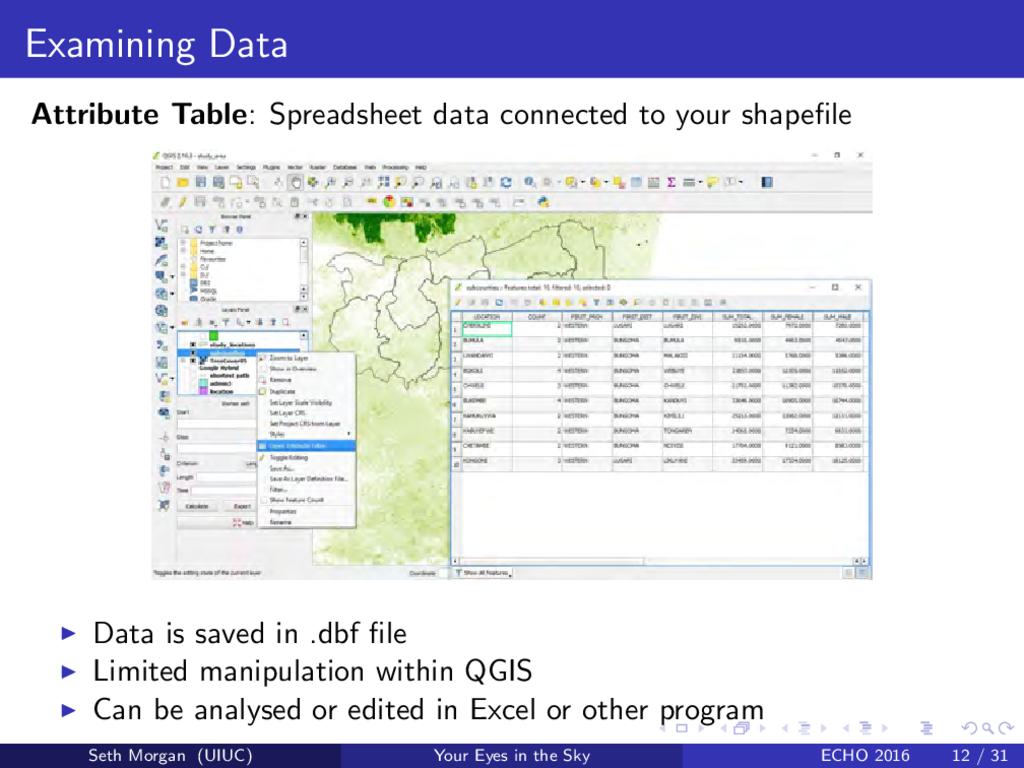
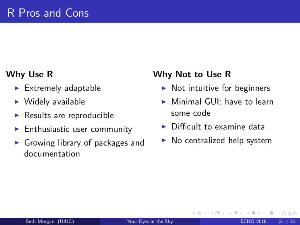
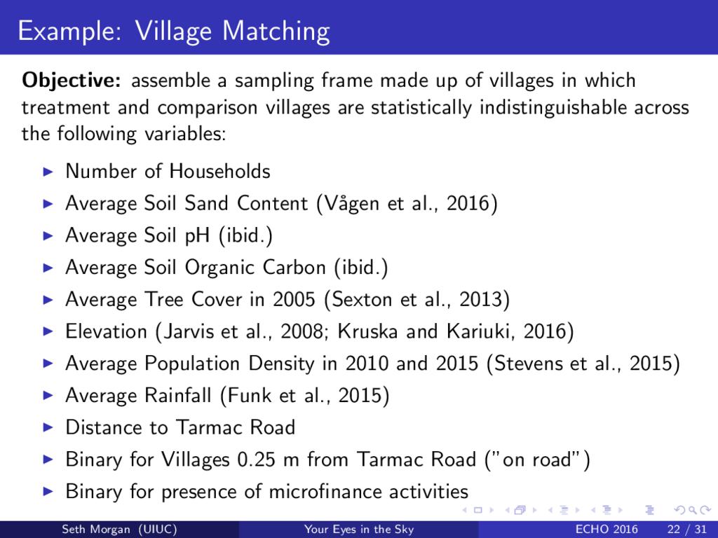
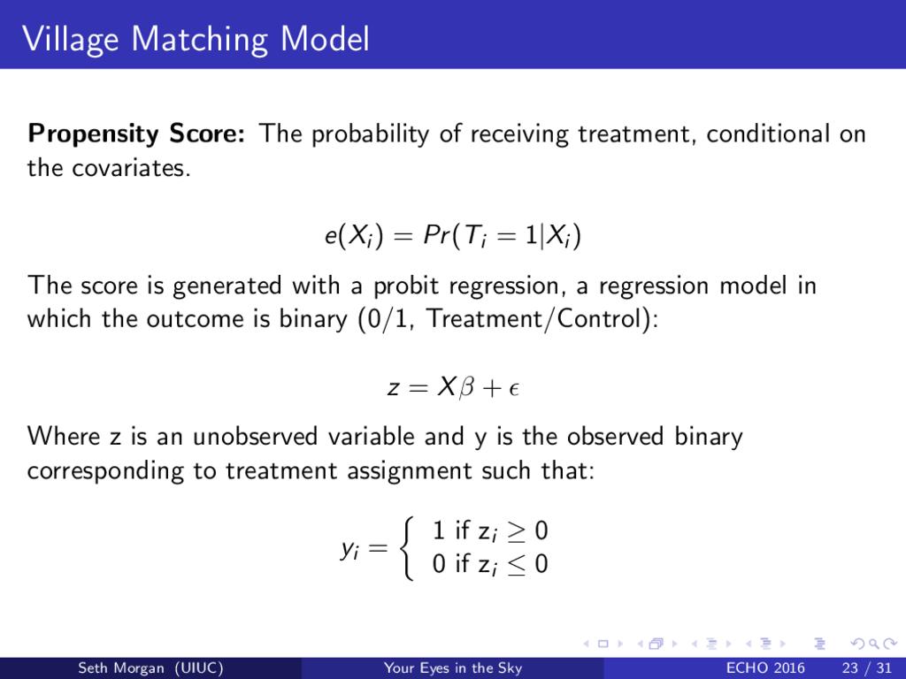
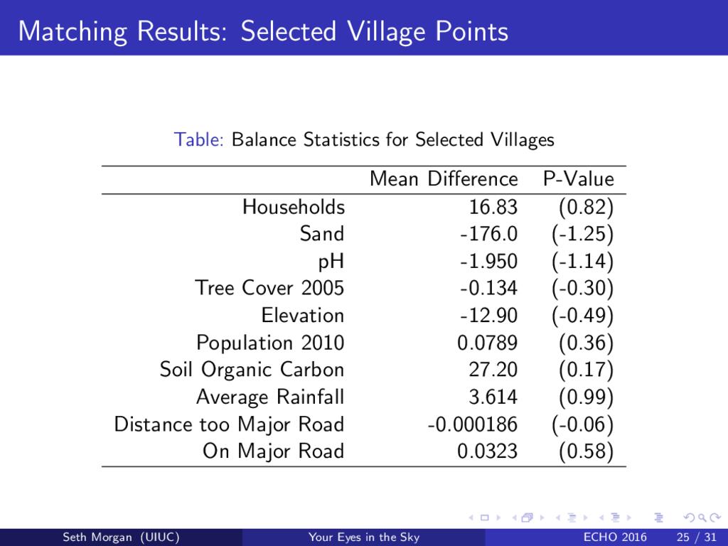
The presentation will cover available geospatial datasets and open-source analysis tools including weather and soil data, and basic applications of QGIS and R for spatial data. Examples will be drawn from the presenter's involvement in the ICRAF impact evaluation "Assessing the Downstream Socioeconomic & Land Health Impacts of'Agroforestry in Kenya." The focus will be on freely available geospatial data and open-source tools which researchers and practitioners can use to create soil and weather maps, compare program to nonprogram areas and improve both planning and evaluation efforts.
Presenter: Seth Morgan is an M.S. Candidate in Applied Economics at the University of Illinois, currently serving as a Research Fellow at ICRAF (The World Agroforestry Centre) in Nairobi, Kenya. Seth was an ECHO Intern (Rainforest) in 2011-2012 and an ECHO Asia Intern in 2012-2013. He is married to Claire Le Page Morgan who is currently working as an intern at ICRAF. They are currently working in Kenya until January 2017 when they will return to their base in Champaign-Urbana, Ilinois.